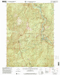
1998 Map of Pearsoll Peak
USGS Topo · Published 2001About this map
The Siskiyou National Forest and the Kalmiopsis Wilderness dominate this 1990s landscape, centered on the high terrain of Pearsoll Peak. The mapping details a legacy of extraction, showing numerous mineral sites such as the Deep Gorge Mine, Chrome King Mine, and Fall Creek Copper Mine along the steep canyon walls. Many of these Prospect sites and mines are located near the Illinois River Scenic and Wild National River, which carves through the quadrangle with named bars like Miami Bar and Robertson Bar.
Find a feature on this map
58 named features on this map. Tap any name to fly to it.
Don’t see what you’re looking for? This feature index may not catch every label — zoom into the map to look around manually.
Map Details
Editions of this 1998 Pearsoll Peak Map
This is the sole edition of this map. No revisions or reprints were ever made.
Other maps of this area

1917 · Kerby
USGS Topo · 1:125,000

1918 · Kerby
USGS Topo · 1:125,000

1945 · Kerby
USGS Topo · 1:125,000

1954 · Cave Junction
USGS Topo · 1:62,500

1954 · Selma
USGS Topo · 1:62,500

1954 · Chetco Peak
USGS Topo · 1:62,500

1954 · Pearsoll Peak
USGS Topo · 1:62,500

1955 · Medford
USGS Topo · 1:250,000

1957 · Medford
USGS Topo · 1:250,000

1958 · Medford
USGS Topo · 1:250,000