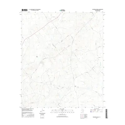
2016 Map of Pearsons Chapel
USGS Topo · Published 2016About this map
Pearsons Chapel serves as the namesake hub of this rural Houston County landscape, where the local community is defined by its small churches and ancestral burial grounds. To the north, Bynum Cem sits along a quiet ridge, a key landmark for genealogists tracing family roots in this corner of East Texas. The terrain is deeply etched by a network of drainage systems, including Hales Gully and several named waterways like Kellisons Cr and Tantabogue Cr that dictate the winding paths of local roads.
Find a feature on this map
43 named features on this map. Tap any name to fly to it.
Don’t see what you’re looking for? This feature index may not catch every label — zoom into the map to look around manually.
Map Details
Editions of this 2016 Pearsons Chapel Map
This is the sole edition of this map. No revisions or reprints were ever made.
Other maps of this area

1950 · Crockett
USGS Topo · 1:24,000

1951 · Crockett
USGS Topo · 1:24,000

1953 · Palestine
USGS Topo · 1:250,000

1957 · Palestine
USGS Topo · 1:250,000

1962 · Lovelady South
USGS Topo · 1:24,000

1963 · Lovelady North
USGS Topo · 1:24,000

1964 · Sand Ridge
USGS Topo · 1:24,000

1964 · Austonio
USGS Topo · 1:24,000

1964 · Porter Springs
USGS Topo · 1:24,000

1964 · Pearsons Chapel
USGS Topo · 1:24,000