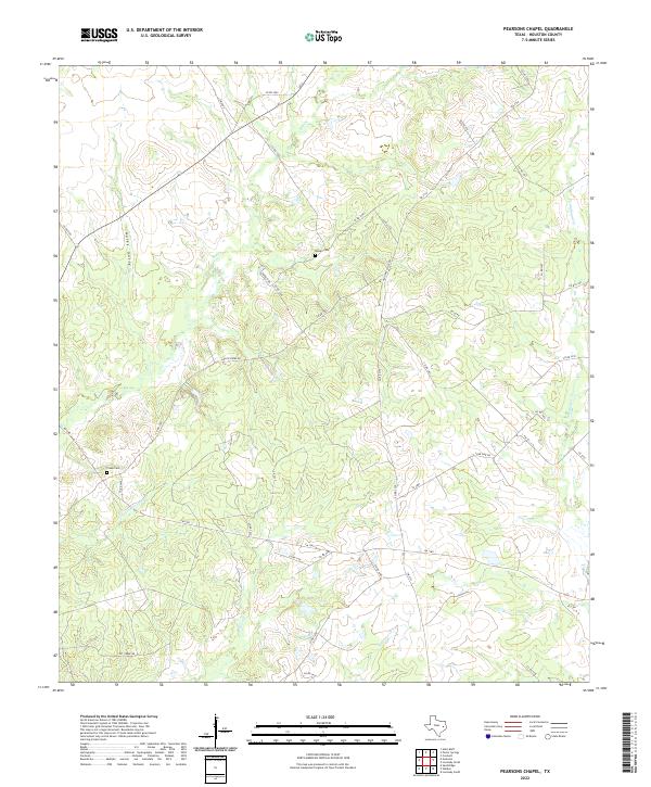
2022 Map of Pearsons Chapel
USGS Topo · Published 2022About this map
Bynum Cem and Creek Cem sit among the gently undulating headwaters of the East Texas piney woods, marking the early family foundations of this Houston County landscape. The area is defined by a dense network of seasonal drainages, including Big Cr and the winding Tantabogue Cr, which carve shallow valleys through the terrain. Unlike more urbanized regions, the settlement pattern here remains dictated by these watercourses and a web of rural routes like Lone Pine Rd and Lost Creek Rd. The presence of features like Hales Gully and Georgia Camp Cr suggests a history of localized naming tied to specific families or early campsites. This 2022 data reflects a landscape that has maintained its rural character, where the intersection of Farm to Market roads like FM 1280 and FM 2110 serves as the primary modern infrastructure over a land still defined by its traditional creeks and cemeteries.
Find a feature on this map
45 named features on this map. Tap any name to fly to it.
Don’t see what you’re looking for? This feature index may not catch every label — zoom into the map to look around manually.
Map Details
Editions of this 2022 Pearsons Chapel Map
This is the sole edition of this map. No revisions or reprints were ever made.
Other maps of this area

1950 · Crockett
USGS Topo · 1:24,000

1951 · Crockett
USGS Topo · 1:24,000

1953 · Palestine
USGS Topo · 1:250,000

1957 · Palestine
USGS Topo · 1:250,000

1962 · Lovelady South
USGS Topo · 1:24,000

1963 · Lovelady North
USGS Topo · 1:24,000

1964 · Sand Ridge
USGS Topo · 1:24,000

1964 · Austonio
USGS Topo · 1:24,000

1964 · Porter Springs
USGS Topo · 1:24,000

1964 · Pearsons Chapel
USGS Topo · 1:24,000