
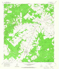
1964 Map of Pearsons Chapel
USGS Topo · Published 1967About this map
Pearsons Chapel serves as the central point of this mid-1960s landscape, where small rural settlements and religious sites anchor the local geography. The area is defined by a dense network of watercourses, including the westward-flowing Big Creek and the meandering Georgia Camp Creek, which passes by the Georgia Camp Ch and its associated settlement. These labels suggest a community long tied to the creek basins, with further evidence of family lineage found at the Bynum Cem and the Cooper Ch near the northern boundary.
Find a feature on this map
15 named features on this map. Tap any name to fly to it.
Don’t see what you’re looking for? This feature index may not catch every label — zoom into the map to look around manually.
Map Details
Editions of this 1964 Pearsons Chapel Map
This is the sole edition of this map. No revisions or reprints were ever made.
Other maps of this area

1950 · Crockett
USGS Topo · 1:24,000

1951 · Crockett
USGS Topo · 1:24,000

1953 · Palestine
USGS Topo · 1:250,000

1957 · Palestine
USGS Topo · 1:250,000

1962 · Lovelady South
USGS Topo · 1:24,000

1963 · Lovelady North
USGS Topo · 1:24,000

1964 · Sand Ridge
USGS Topo · 1:24,000

1964 · Austonio
USGS Topo · 1:24,000

1964 · Porter Springs
USGS Topo · 1:24,000
1964 · Weldon
USGS Topo · 1:24,000