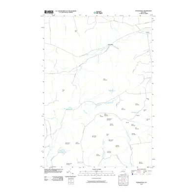
2010 Map of Peasleeville
USGS Topo · Published 2010About this map
Peasleeville serves as the central settlement in this upland region of Clinton County, situated where Westcott Rd and Peasleeville Rd meet along the Salmon River. The landscape is defined by the high peaks and dense hydrography of the Adirondack Park, featuring numerous summits named for local families such as Larry Ryan Mountain, Nancy Ryan Mountain, and Mitchell Mountain.
Find a feature on this map
57 named features on this map. Tap any name to fly to it.
Don’t see what you’re looking for? This feature index may not catch every label — zoom into the map to look around manually.
Map Details
Editions of this 2010 Peasleeville Map
This is the sole edition of this map. No revisions or reprints were ever made.
Other maps of this area

1895 · Ausable
USGS Topo · 1:62,500

1896 · Lake Placid
USGS Topo · 1:62,500

1898 · Lake Placid
USGS Topo · 1:62,500

1903 · Ausable
USGS Topo · 1:62,500

1911 · Lyon Mountain
USGS Topo · 1:62,500

1913 · Dannemora
USGS Topo · 1:62,500

1913 · Lyon Mountain
USGS Topo · 1:62,500

1931 · Lyon Mountain
USGS Topo · 1:62,500

1950 · Lake Champlain
USGS Topo · 1:250,000

1953 · Lake Placid
USGS Topo · 1:62,500