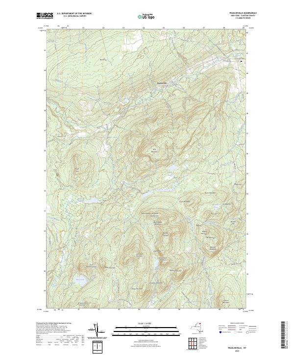
2023 Map of Peasleeville
USGS Topo · Published 2023About this map
Peasleeville sits at the northern edge of this high-elevation landscape, where the Salmon River cuts through a dense concentration of Adirondack peaks. This modern survey illustrates the rugged geography of Clinton County, showing how historical settlements and cemeteries like the Peasleeville Cem are constrained by the rising elevations of Terry Mountain and Quinn Mountain. The southern half of the map is dominated by the Adirondack Park Preserve, featuring a string of distinct summits including Little Nineteen Mountain, Big Nineteen Mountain, and the prominent point known as The Pinnacle. Small mountain lakes and brooks, such as Military Pond and Caldwell Brook, drain the uplands into the Little Ausable River system. The naming conventions throughout the area, from Larry Ryan Mountain to Nancy Ryan Mountain, reflect a landscape long defined by local family heritage and topographical landmarks.
Find a feature on this map
64 named features on this map. Tap any name to fly to it.
Don’t see what you’re looking for? This feature index may not catch every label — zoom into the map to look around manually.
Map Details
Editions of this 2023 Peasleeville Map
This is the sole edition of this map. No revisions or reprints were ever made.
Other maps of this area

1895 · Ausable
USGS Topo · 1:62,500

1896 · Lake Placid
USGS Topo · 1:62,500

1898 · Lake Placid
USGS Topo · 1:62,500

1903 · Ausable
USGS Topo · 1:62,500

1911 · Lyon Mountain
USGS Topo · 1:62,500

1913 · Dannemora
USGS Topo · 1:62,500

1913 · Lyon Mountain
USGS Topo · 1:62,500

1931 · Lyon Mountain
USGS Topo · 1:62,500

1950 · Lake Champlain
USGS Topo · 1:250,000

1953 · Lake Placid
USGS Topo · 1:62,500