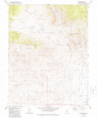
1980 Map of Peavine Ranch
USGS Topo · Published 1990About this map
Peavine Ranch and its adjacent Forest Service Station anchor this high-elevation landscape in the Toiyabe Range during the late 1970s. The terrain is defined by a series of deep drainages including Dry Canyon, Horse Canyon, and Peavine Canyon that descend toward the broad flats of the Big Smoky Valley. This survey captures the vital water infrastructure of the arid basin, noting numerous remote water sources such as Seyler Spring, Mustang Spring, and various unnamed Springs. The influence of federal land management is evident throughout the Toiyabe National Forest, with a designated Campground and multiple Corral sites indicating a mix of recreational use and ongoing livestock operations. Small-scale mineral exploration is marked by several Prospects and a singular Prospect located near the southern indefinite boundary.
Find a feature on this map
27 named features on this map. Tap any name to fly to it.
Don’t see what you’re looking for? This feature index may not catch every label — zoom into the map to look around manually.
Map Details
Editions of this 1980 Peavine Ranch Map
2 editions found
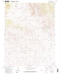
Other maps of this area

1907 · Tonopah
USGS Topo · 1:250,000

1908 · Tonopah
USGS Topo · 1:250,000

1956 · Tonopah
USGS Topo · 1:250,000

1959 · Tonopah
USGS Topo · 1:250,000

1962 · Tonopah
USGS Topo · 1:250,000

1963 · Baxter Spring
USGS Topo · 1:62,500

1964 · San Antonio Ranch
USGS Topo · 1:62,500

1971 · Seyler Peak
USGS Topo · 1:24,000

1971 · Pablo Canyon Ranch
USGS Topo · 1:24,000

1980 · Secret Basin
USGS Topo · 1:24,000