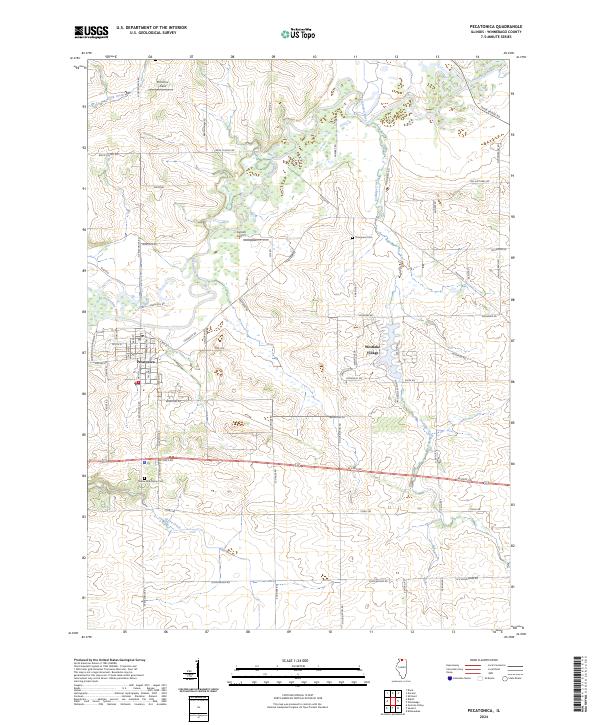
2024 Map of Pecatonica
USGS Topo · Published 2024About this map
The Pecatonica River snakes through the northern Winnebago County landscape, defining the topography around the village of Pecatonica. This 2024 survey captures the area's balance of established agricultural plots and modern residential clusters, most notably the lakeside development at Westlake Village. The road network follows a rigid grid of family-named routes such as Barningham Rd and Wiegert Rd, revealing the enduring land-ownership patterns of this rural Illinois corridor.
Find a feature on this map
69 named features on this map. Tap any name to fly to it.
Don’t see what you’re looking for? This feature index may not catch every label — zoom into the map to look around manually.
Map Details
Editions of this 2024 Pecatonica Map
This is the sole edition of this map. No revisions or reprints were ever made.
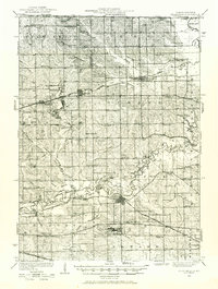
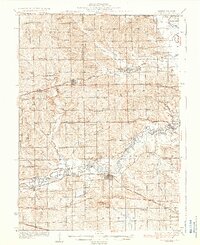
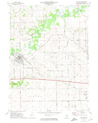
Historical Maps of Pecatonica Township Through Time
4 maps found
Featured Locations
- Pecatonica Township, IL
- Seward Township, IL
- Winnebago Township, IL
- Pecatonica, Pecatonica Township
- Winnebago, Winnebago Township