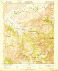
1950 Map of Pechanga
USGS Topo · Published 1950About this map
The Pechanga Indian Reservation and Pala Indian Reservation anchor this 1950 survey along the border of Riverside and San Diego Counties. The landscape is defined by the Temecula River and the canyon-cut slopes of Oak Mountain and Agua Tibia Mountain. Cultural markers of the era include the San Gabriel Church and an Indian Burial Ground near Pauba Ranch, providing vital geographic context for family historians.
Find a feature on this map
45 named features on this map. Tap any name to fly to it.
Don’t see what you’re looking for? This feature index may not catch every label — zoom into the map to look around manually.
Map Details
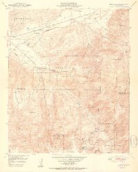
Editions of this 1950 Pechanga Map
2 editions found
Other maps of this area

1901 · Southern California Sheet No. 1
USGS Topo · 1:250,000

1901 · San Jacinto
USGS Topo · 1:125,000

1901 · Elsinore
USGS Topo · 1:125,000

1901 · San Luis Rey
USGS Topo · 1:125,000

1903 · Ramona
USGS Topo · 1:125,000

1904 · Southern California Sheet No. 2
USGS Topo · 1:250,000

1904 · Southern California Sheet No. 1
USGS Topo · 1:250,000

1939 · Palomar Mountain
USGS Topo · 1:62,500

1942 · Temecula
USGS Topo · 1:62,500

1942 · Hemet
USGS Topo · 1:62,500