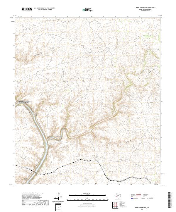
2022 Map of Pecos High Bridge
USGS Topo · Published 2022About this map
The Pecos River carves a winding path through the deeply incised limestone plateaus of Val Verde County, Texas, in this 2022 survey. This arid landscape is characterized by a network of drainage systems including Shackelford Canyon to the west and the confluence of Faro Canyon and Dead Mans Canyon to the east. These steep-walled canyons reflect the unique geomorphology of the Trans-Pecos region, where intermittent water flow has sculpted the terrain over millennia.
Find a feature on this map
7 named features on this map. Tap any name to fly to it.
Don’t see what you’re looking for? This feature index may not catch every label — zoom into the map to look around manually.
Map Details
Editions of this 2022 Pecos High Bridge Map
This is the sole edition of this map. No revisions or reprints were ever made.
Other maps of this area

1941 · Feely
USGS Topo · 1:62,500

1943 · Shumla
USGS Topo · 1:62,500

1944 · Mouth Of Pecos
USGS Topo · 1:62,500

1944 · Baker Crossing
USGS Topo · 1:62,500

1958 · Del Rio
USGS Topo · 1:250,000

1964 · Del Rio
USGS Topo · 1:250,000
1972 · Zuberbueler Bend NW
USGS Topo · 1:24,000

1972 · Seminole Canyon
USGS Topo · 1:24,000
1972 · Comstock
USGS Topo · 1:24,000
1973 · Still Canyon
USGS Topo · 1:24,000