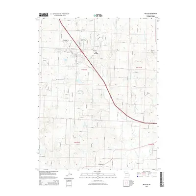
2015 Map of Peculiar
USGS Topo · Published 2015About this map
The settlement of Peculiar and its historical predecessor Old Peculiar anchor this landscape in northern Cass County. The area is defined by the branching waterways of the South Grand River system, including the E Br S Grand River and its numerous tributaries such as Wolf Cr, Adams Br, and Polecat Cr. This drainage network influenced the placement of early homesteads and transport routes long before modern developments appeared.
Find a feature on this map
121 named features on this map. Tap any name to fly to it.
Don’t see what you’re looking for? This feature index may not catch every label — zoom into the map to look around manually.
Map Details
Editions of this 2015 Peculiar Map
This is the sole edition of this map. No revisions or reprints were ever made.
Other maps of this area

1887 · Harrisonville
USGS Topo · 1:125,000

1887 · Olathe
USGS Topo · 1:125,000

1892 · Harrisonville
USGS Topo · 1:125,000

1893 · Olathe
USGS Topo · 1:125,000

1894 · Harrisonville
USGS Topo · 1:125,000

1947 · Lawrence
USGS Topo · 1:250,000

1950 · Lawrence
USGS Topo · 1:250,000
1953 · Belton
USGS Topo · 1:24,000

1953 · Freeman
USGS Topo · 1:24,000

1953 · West Line
USGS Topo · 1:24,000