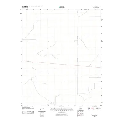
2010 Map of Pedernal
USGS Topo · Published 2010About this map
Pedernal and Dunmoor appear as central points of reference in this high-desert landscape, captured during the first decade of the 21st century. The geography is defined by its rural transit network, most notably the path of Highway 60, which bisects the quadrangle as a primary east-west corridor. A system of numbered county roads, including County Rd-C089 and County Rd-C088, provides the necessary infrastructure for ranching or sparse residential pockets. The layout suggests a classic New Mexico ranching environment where vast distances are managed through a sparse but essential grid of roads like County Rd-C057 and County Rd-C037. This survey by the U.S. Geological Survey offers a clear record of land use and property boundaries in Torrance County before more recent developments.
Find a feature on this map
8 named features on this map. Tap any name to fly to it.
Don’t see what you’re looking for? This feature index may not catch every label — zoom into the map to look around manually.
Map Details
Editions of this 2010 Pedernal Map
This is the sole edition of this map. No revisions or reprints were ever made.
Other maps of this area

1954 · Fort Sumner
USGS Topo · 1:250,000

1958 · Fort Sumner
USGS Topo · 1:250,000

1960 · Lobo Hill
USGS Topo · 1:62,500

1978 · Negra SW
USGS Topo · 1:24,000

1978 · Pedernal Mountain
USGS Topo · 1:24,000

1978 · Pedernal
USGS Topo · 1:24,000

1978 · North Lucy
USGS Topo · 1:24,000

1978 · Negra SE
USGS Topo · 1:24,000

1978 · Negra
USGS Topo · 1:24,000

1978 · Lucy
USGS Topo · 1:24,000