
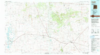
1978 Map of Lucy
USGS Topo · Published 1978About this map
Atchison Topeka and Santa Fe railroad tracks slice diagonally across this 1978 landscape in Torrance County, anchoring the small settlements of Lucy and Culebra. This high-desert region is defined by its industrial infrastructure and rail-line economy, with bench marks and survey points tracing the line's elevation as it moves through the area. Local resource extraction is evident near the tracks at the Gravel Pit, while a long-distance Pipeline cuts through the northern sections of the township. The map illustrates a sparse but functional grid of township boundaries, specifically the transition between T 6 N and T 5 N, providing a clear record of land division and utility corridors in central New Mexico during the late 1970s.
Find a feature on this map
6 named features on this map. Tap any name to fly to it.
Don’t see what you’re looking for? This feature index may not catch every label — zoom into the map to look around manually.
Map Details
Editions of this 1978 Lucy Map
This is the sole edition of this map. No revisions or reprints were ever made.
Other maps of this area

1954 · Fort Sumner
USGS Topo · 1:250,000

1958 · Fort Sumner
USGS Topo · 1:250,000

1960 · Lobo Hill
USGS Topo · 1:62,500

1978 · Laguna Del Perro North
USGS Topo · 1:24,000

1978 · Negra SW
USGS Topo · 1:24,000

1978 · Pedernal Mountain
USGS Topo · 1:24,000

1978 · Pedernal
USGS Topo · 1:24,000

1978 · Laguna Del Perro South
USGS Topo · 1:24,000

1978 · Rattlesnake Hill
USGS Topo · 1:24,000
1984 · Vaughn
USGS Topo · 1:100,000