
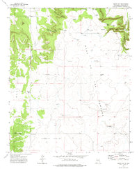
1978 Map of Laguna Del Perro South
USGS Topo · Published 1978About this map
Laguna Del Perro (Salt) dominates this high-desert basin in Torrance County, appearing as a series of ephemeral alkali lakes and flats marked simply as Salt. This 1978 survey, based on 1973 aerial photography, reveals a landscape defined by its specialized transport and resource exploration. The Atchison Topeka and Santa Fe railroad cuts a diagonal line across the northern terrain, providing a vital connection through this arid region. The topography is largely defined by depressions and basins, with the elevation rising toward Rattlesnake Hill on the eastern edge. Scattered markers such as a Drill Hole suggest geologic or mineral exploration in a territory where water is scarce and the ground is seasonally transformed by mineral deposits.
Find a feature on this map
5 named features on this map. Tap any name to fly to it.
Don’t see what you’re looking for? This feature index may not catch every label — zoom into the map to look around manually.
Map Details
Editions of this 1978 Laguna Del Perro South Map
This is the sole edition of this map. No revisions or reprints were ever made.
Other maps of this area

1917 · Estancia
USGS Topo · 1:125,000

1954 · Fort Sumner
USGS Topo · 1:250,000

1954 · Socorro
USGS Topo · 1:250,000

1956 · Mountainair
USGS Topo · 1:62,500

1958 · Socorro
USGS Topo · 1:250,000

1958 · Fort Sumner
USGS Topo · 1:250,000

1962 · Socorro
USGS Topo · 1:250,000
1972 · Round Top
USGS Topo · 1:24,000

1978 · Laguna Del Perro North
USGS Topo · 1:24,000

1978 · Lucy
USGS Topo · 1:24,000