
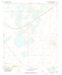
1978 Map of Laguna Del Perro North
USGS Topo · Published 1978About this map
Laguna Del Perro (Salt) dominates this Estancia Valley landscape, its expansive alkali flats and numerous smaller salt basins revealing a highly specialized geological environment. Surveyed in the late 1970s, the map highlights the intricate boundaries of these basins, including La Salina in the southern reaches. The terrain is characterized by subtle elevation changes and depressions, where ephemeral water and mineral deposits create a distinct pattern of salt crusts. Human infrastructure is minimal, marked only by isolated features like a Well or a Tank, which suggest the logistical challenges and sparse ranching activity in this arid New Mexico interior. The survey captures a moment in time where the physical landscape of the salt lakes remains the primary defining characteristic of the region, reflecting both the ancient lakebed history and the modern isolation of the area.
Find a feature on this map
5 named features on this map. Tap any name to fly to it.
Don’t see what you’re looking for? This feature index may not catch every label — zoom into the map to look around manually.
Map Details
Editions of this 1978 Laguna Del Perro North Map
2 editions found
Other maps of this area

1917 · Estancia
USGS Topo · 1:125,000

1954 · Fort Sumner
USGS Topo · 1:250,000

1954 · Socorro
USGS Topo · 1:250,000

1956 · Estancia
USGS Topo · 1:62,500

1956 · Mountainair
USGS Topo · 1:62,500

1958 · Socorro
USGS Topo · 1:250,000

1958 · Fort Sumner
USGS Topo · 1:250,000

1960 · Lobo Hill
USGS Topo · 1:62,500

1962 · Socorro
USGS Topo · 1:250,000

1978 · Laguna Del Perro South
USGS Topo · 1:24,000