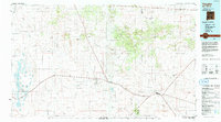
1984 Map of Vaughn
USGS Topo · Published 1992About this map
The high desert plains of the Torrance and Guadalupe County line are defined here by a series of critical transportation corridors. The town of Vaughn serves as a central junction where major routes including U.S. 60, U.S. 54, and U.S. 285 converge with the Atchison Topeka and Santa Fe railroad. This landscape is characterized by its internal drainage basins, most notably the salt flats of Laguna del Perro and La Salina on the western edge. Small settlements such as Encino, Milagro, and Lucy are scattered along the rail and highway lines, supporting the transit-based economy of this arid region. The topography transitions from these low basins up toward prominent landmarks like Pedernal Mountain and Armijo Peak, while numerous drainage features such as Pintada Draw and Arroyo de la Pintada carve through the mesa country.
Find a feature on this map
41 named features on this map. Tap any name to fly to it.
Don’t see what you’re looking for? This feature index may not catch every label — zoom into the map to look around manually.
Map Details
Editions of this 1984 Vaughn Map
This is the sole edition of this map. No revisions or reprints were ever made.
Other maps of this area

1890 · Bernal
USGS Topo · 1:125,000

1891 · Bernal
USGS Topo · 1:125,000

1892 · San Pedro
USGS Topo · 1:125,000

1892 · Corazon
USGS Topo · 1:125,000

1894 · Corazon
USGS Topo · 1:125,000

1894 · Bernal
USGS Topo · 1:125,000

1894 · Lamy
USGS Topo · 1:125,000

1917 · Estancia
USGS Topo · 1:125,000

1954 · Santa Fe
USGS Topo · 1:250,000

1954 · Fort Sumner
USGS Topo · 1:250,000