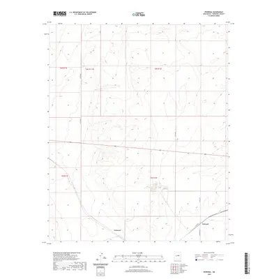
2020 Map of Pedernal
USGS Topo · Published 2020About this map
Pedernal and the nearby locality of Dummoor anchor this high-plains landscape in Torrance County, where the grid of the Public Land Survey System defines the modern distribution of ranching and transit. The map illustrates a sparse network of county roads, such as Co Rd C042 and Eshelman Rd, which navigate the subtle drainage patterns and topography of the New Mexico interior. This recent survey shows the persistent layout of section lines and townships, including t5n r12e and t6n r12e, reflecting the enduring surveyor's imprint on the American West. The concentration of labeled features in the southeastern corner near Co Rd C058 suggests the primary corridor of local activity, contrasting with the open, undeveloped sections to the north and west.
Find a feature on this map
12 named features on this map. Tap any name to fly to it.
Don’t see what you’re looking for? This feature index may not catch every label — zoom into the map to look around manually.
Map Details
Editions of this 2020 Pedernal Map
This is the sole edition of this map. No revisions or reprints were ever made.
Other maps of this area

1954 · Fort Sumner
USGS Topo · 1:250,000

1958 · Fort Sumner
USGS Topo · 1:250,000

1960 · Lobo Hill
USGS Topo · 1:62,500

1978 · Negra SW
USGS Topo · 1:24,000

1978 · Pedernal Mountain
USGS Topo · 1:24,000

1978 · Pedernal
USGS Topo · 1:24,000

1978 · North Lucy
USGS Topo · 1:24,000

1978 · Negra SE
USGS Topo · 1:24,000

1978 · Negra
USGS Topo · 1:24,000

1978 · Lucy
USGS Topo · 1:24,000