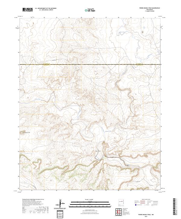
2023 Map of Pedro Miguel Peak
USGS Topo · Published 2023About this map
The Pecos River carves a winding path through this corner of New Mexico, where the high desert landscape meets the southern reaches of the Sangre de Cristo foothills. The confluence of the Gallinas River and the Pecos serves as a central geographic anchor, creating a complex network of drainages and canyons, most notably Deer Canyon. This area is defined by its topographical prominence, anchored by the volcanic silhouette of Pedro Miguel Peak in the west.
Find a feature on this map
11 named features on this map. Tap any name to fly to it.
Don’t see what you’re looking for? This feature index may not catch every label — zoom into the map to look around manually.
Map Details
Editions of this 2023 Pedro Miguel Peak Map
This is the sole edition of this map. No revisions or reprints were ever made.
Other maps of this area

1890 · Bernal
USGS Topo · 1:125,000

1891 · Bernal
USGS Topo · 1:125,000

1892 · Corazon
USGS Topo · 1:125,000

1894 · Corazon
USGS Topo · 1:125,000

1894 · Bernal
USGS Topo · 1:125,000

1954 · Santa Fe
USGS Topo · 1:250,000

1958 · Santa Fe
USGS Topo · 1:250,000

1960 · Apache Springs
USGS Topo · 1:62,500

1963 · Colonias
USGS Topo · 1:24,000

1963 · Pedro Miguel Peak
USGS Topo · 1:24,000