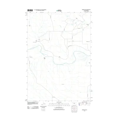
2012 Map of Pedro NW
USGS Topo · Published 2012About this map
The Cheyenne River winds through the heart of this Pennington County landscape, defining the topography between wide plains and eroded draws. This 2012 survey reveals a rural territory structured by long-standing ranching operations, with family names marking the land at sites such as Freiberg Ranch, King Ranch, and Denke Ranch. The terrain is deeply inscribed by drainage systems like Tepee Cr and Deep Cr, alongside descriptively named features such as Poison Weed Draw and Mud Draw. A sparse network of county roads, including Cheyenne Crossing Rd and Wall Pedro Rd, connects these remote outposts. The concentration of ranch labels reflects the enduring agricultural character of the region, where land use remains tied to the natural water sources and the broad grazing land of Davidson Flat.
Find a feature on this map
28 named features on this map. Tap any name to fly to it.
Don’t see what you’re looking for? This feature index may not catch every label — zoom into the map to look around manually.
Map Details
Editions of this 2012 Pedro NW Map
This is the sole edition of this map. No revisions or reprints were ever made.
Other maps of this area

1953 · Rapid City
USGS Topo · 1:250,000

1954 · Dalzell SE
USGS Topo · 1:24,000

1954 · Dalzell NE
USGS Topo · 1:24,000

1955 · Pedro
USGS Topo · 1:24,000

1955 · Pedro NW
USGS Topo · 1:24,000

1955 · Creighton
USGS Topo · 1:24,000

1955 · Howes
USGS Topo · 1:24,000

1955 · Pedro SE
USGS Topo · 1:24,000

1957 · Rapid City
USGS Topo · 1:250,000

1983 · Plainview
USGS Topo · 1:24,000