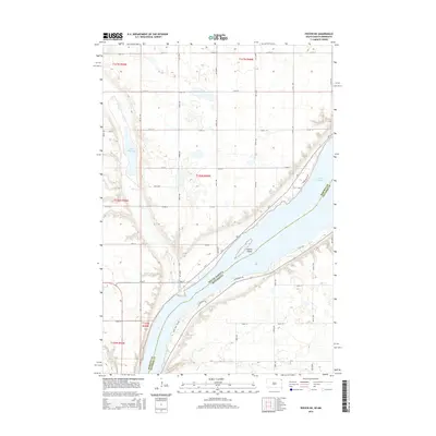
2015 Map of Peever NE
USGS Topo · Published 2015About this map
Lake Traverse dominates the eastern portion of this landscape, forming the natural boundary between South Dakota and Minnesota. The shoreline is marked by early 21st-century residential and recreational development, evidenced by names like Klems Beach Rd, Waterfront Dr, and Wing and Fin Dr. The terrain rises sharply from the water's edge, particularly near Jensen Island, where the elevation contours indicate a steep ascent from the lake basin to the surrounding agricultural plains.
Find a feature on this map
44 named features on this map. Tap any name to fly to it.
Don’t see what you’re looking for? This feature index may not catch every label — zoom into the map to look around manually.
Map Details
Editions of this 2015 Peever NE Map
This is the sole edition of this map. No revisions or reprints were ever made.
Other maps of this area

1915 · White Rock
USGS Topo · 1:62,500

1916 · Peever
USGS Topo · 1:62,500

1916 · Beardsley
USGS Topo · 1:62,500

1917 · New Effington
USGS Topo · 1:62,500

1918 · Peever
USGS Topo · 1:62,500

1918 · White Rock
USGS Topo · 1:62,500

1918 · Beardsley
USGS Topo · 1:62,500

1953 · Milbank
USGS Topo · 1:250,000

1958 · Milbank
USGS Topo · 1:250,000

1971 · Browns Valley
USGS Topo · 1:24,000