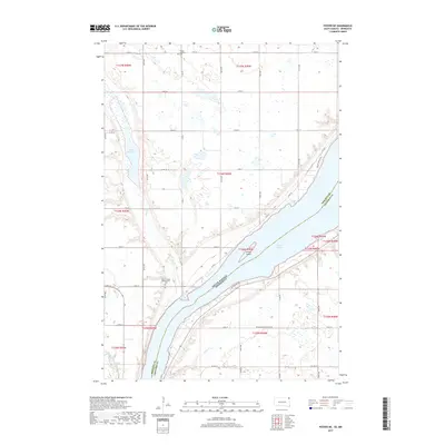
2017 Map of Peever NE
USGS Topo · Published 2017About this map
Lake Traverse dominates this landscape, serving as the natural boundary between South Dakota and Minnesota. The shoreline is punctuated by Jensen Island and the mouth of the Little Minnesota River, which winds through the southern terrain alongside Steer Cr. The map reveals a rural community anchored by its places of rest, such as the Lake Traverse Presbyterian Cem near the lake’s edge and the Trinity Lutheran Cem further north. A network of section-line roads, including Co Rd 2 and Co Hwy 4, connects these remote sites, while Lake Bdesaka sits in the northwest corner. This 2017 survey details the contemporary intersection of the Lake Traverse District with the neighboring Minnesota borderlands, showing how modern access like Waldos Beach Rd follows the historical contours of the water.
Find a feature on this map
41 named features on this map. Tap any name to fly to it.
Don’t see what you’re looking for? This feature index may not catch every label — zoom into the map to look around manually.
Map Details
Editions of this 2017 Peever NE Map
This is the sole edition of this map. No revisions or reprints were ever made.
Other maps of this area

1915 · White Rock
USGS Topo · 1:62,500

1916 · Peever
USGS Topo · 1:62,500

1916 · Beardsley
USGS Topo · 1:62,500

1917 · New Effington
USGS Topo · 1:62,500

1918 · Peever
USGS Topo · 1:62,500

1918 · White Rock
USGS Topo · 1:62,500

1918 · Beardsley
USGS Topo · 1:62,500

1953 · Milbank
USGS Topo · 1:250,000

1958 · Milbank
USGS Topo · 1:250,000

1971 · Browns Valley
USGS Topo · 1:24,000