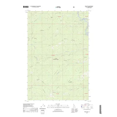
2020 Map of Peggy Peak
USGS Topo · Published 2020About this map
The St. Joe National Forest defines this high-elevation landscape in Shoshone County, characterized by a series of prominent peaks and ridgelines. Waterways including Mosquito Creek and Fly Creek drain the north, while the Saint Joe Wild and Scenic River skirts the northeastern corner. In the south, Scribner Falls marks a sharp drop in elevation near the headwaters of Upper Canyon Creek.
Find a feature on this map
51 named features on this map. Tap any name to fly to it.
Don’t see what you’re looking for? This feature index may not catch every label — zoom into the map to look around manually.
Map Details
Editions of this 2020 Peggy Peak Map
This is the sole edition of this map. No revisions or reprints were ever made.
Other maps of this area

1911 · Lolo
USGS Topo · 1:250,000

1913 · Lolo
USGS Topo · 1:250,000

1914 · Avery
USGS Topo · 1:125,000

1917 · Avery
USGS Topo · 1:125,000

1918 · St Regis
USGS Topo · 1:125,000

1919 · St. Regis
USGS Topo · 1:125,000

1923 · Washington Creek
USGS Topo · 1:125,000

1956 · Wallace
USGS Topo · 1:250,000

1956 · Hamilton
USGS Topo · 1:250,000

1957 · Simmons Peak
USGS Topo · 1:62,500