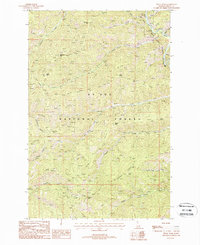
1988 Map of Peggy Peak
USGS Topo · Published 1988About this map
St Joe Wild and Scenic River defines the northeast corner of this remote mountain landscape in the St Joe National Forest. This 1980s provisional study documents a high-elevation environment dominated by a complex network of ridges and peaks, including Peggy Peak, Granite Peak, and Bad Bear Peak. The drainage patterns are clearly defined by numerous named waterways such as Mosquito Creek, Fly Creek, and Bad Bear Creek, which feed into the primary river system.
Find a feature on this map
33 named features on this map. Tap any name to fly to it.
Don’t see what you’re looking for? This feature index may not catch every label — zoom into the map to look around manually.
Map Details
Editions of this 1988 Peggy Peak Map
This is the sole edition of this map. No revisions or reprints were ever made.
Other maps of this area

1911 · Lolo
USGS Topo · 1:250,000

1913 · Lolo
USGS Topo · 1:250,000

1914 · Avery
USGS Topo · 1:125,000

1917 · Avery
USGS Topo · 1:125,000

1918 · St Regis
USGS Topo · 1:125,000

1919 · St. Regis
USGS Topo · 1:125,000

1923 · Washington Creek
USGS Topo · 1:125,000

1956 · Wallace
USGS Topo · 1:250,000

1956 · Hamilton
USGS Topo · 1:250,000

1957 · Simmons Peak
USGS Topo · 1:62,500