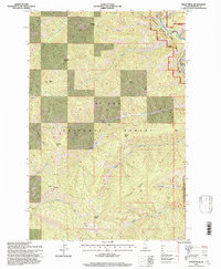
1995 Map of Peggy Peak
USGS Topo · Published 1997About this map
St Joe National Forest dominates this Idaho landscape, characterized by a complex network of ridgelines and high summits within the Bitterroot Range. The protected corridor of the St Joe Wild and Scenic River winds through the northeastern corner, serving as a primary drainage point for numerous mountain streams. Prominent elevations such as Peggy Peak, Mosquito Peak, and Badger Mountain define the topography, while Copper Ridge runs diagonally across the southern half of the quadrangle. The map reveals a land managed for its timber and natural resources, featuring the open expanse of Elk Prairie and the secluded Twin Lakes. Small watercourses like Beaver Creek and Copper Creek carve deep valleys between peaks, illustrating the drainage patterns that feed the larger river system in this remote Shoshone County region.
Find a feature on this map
32 named features on this map. Tap any name to fly to it.
Don’t see what you’re looking for? This feature index may not catch every label — zoom into the map to look around manually.
Map Details
Editions of this 1995 Peggy Peak Map
This is the sole edition of this map. No revisions or reprints were ever made.
Other maps of this area

1911 · Lolo
USGS Topo · 1:250,000

1913 · Lolo
USGS Topo · 1:250,000

1914 · Avery
USGS Topo · 1:125,000

1917 · Avery
USGS Topo · 1:125,000

1918 · St Regis
USGS Topo · 1:125,000

1919 · St. Regis
USGS Topo · 1:125,000

1923 · Washington Creek
USGS Topo · 1:125,000

1956 · Wallace
USGS Topo · 1:250,000

1956 · Hamilton
USGS Topo · 1:250,000

1957 · Simmons Peak
USGS Topo · 1:62,500