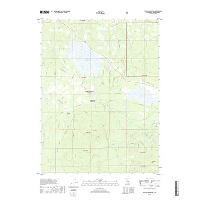
2018 Map of Pegleg Mountain
USGS Topo · Published 2018About this map
Lassen National Forest terrain dominates this survey of Lassen County, where the high-altitude hydrology of the Susan River basin is prominently mapped. The landscape is defined by its seasonal wetlands and water storage, most notably the expansive McCoy Flat Reservoir and the nearby Hog Flat Reservoir. These water bodies are surrounded by a dense network of forest roads and historical transport routes, including the Sec 17 Spur and Parallel RR, which hint at the region's logging and rail history. At the center of this activity are the small settlements of Lasco and Westwood Junction, which served as critical points where forest spurs met the main transit lines. The topography rises sharply to the south, marked by the 6,000-foot heights of Pegleg Mtn and Bald Hill. The inclusion of the Pegleg Mtn Lookout (CDF) underscores the vital role of fire observation in this heavily timbered country during the late 2010s.
Find a feature on this map
49 named features on this map. Tap any name to fly to it.
Don’t see what you’re looking for? This feature index may not catch every label — zoom into the map to look around manually.
Map Details
Editions of this 2018 Pegleg Mountain Map
This is the sole edition of this map. No revisions or reprints were ever made.
Other maps of this area

1886 · Honey Lake
USGS Topo · 1:250,000

1886 · Lassen Peak
USGS Topo · 1:250,000

1891 · Honey Lake
USGS Topo · 1:250,000

1892 · Lassen Peak
USGS Topo · 1:250,000

1893 · Honey Lake
USGS Topo · 1:250,000

1894 · Lassen Peak
USGS Topo · 1:250,000

1939 · Halls Flat
USGS Topo · 1:125,000

1955 · Westwood
USGS Topo · 1:62,500

1955 · Westwood
USGS Topo · 1:250,000

1956 · Chester
USGS Topo · 1:62,500