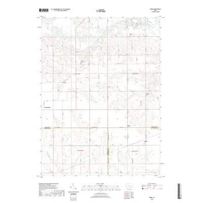
2018 Map of Pekin
USGS Topo · Published 2018About this map
The South Skunk River meanders across the northern reaches of this rural landscape, carving a wide valley through the agricultural heartland of southeast Iowa. At the intersection of Keokuk, Jefferson, and Wapello counties, the small settlements of Martinsburg, Pekin, and Linby anchor the local community. The terrain is defined by a dense network of drainages including Twin Grove Cr, Steady Run, and Competine Creek, which create the undulating relief characteristic of the region's topography.
Find a feature on this map
38 named features on this map. Tap any name to fly to it.
Don’t see what you’re looking for? This feature index may not catch every label — zoom into the map to look around manually.
Map Details
Editions of this 2018 Pekin Map
This is the sole edition of this map. No revisions or reprints were ever made.
Other maps of this area

1954 · Des Moines
USGS Topo · 1:250,000

1956 · Des Moines
USGS Topo · 1:250,000

1956 · Farson
USGS Topo · 1:24,000

1956 · Ottumwa North
USGS Topo · 1:62,500

1957 · Des Moines
USGS Topo · 1:250,000

1965 · Harper
USGS Topo · 1:24,000

1965 · Sigourney
USGS Topo · 1:24,000

1965 · Delta
USGS Topo · 1:24,000

1969 · Des Moines
USGS Topo · 1:250,000
1980 · Ollie
USGS Topo · 1:24,000