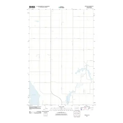
2011 Map of Pekin NE
USGS Topo · Published 2011About this map
Stump Lake dominates the southwestern corner of this rural Nelson County landscape, where the shifting shoreline meets a rigid grid of agricultural section lines. This 2011 survey reveals the hydraulic character of the region, specifically how Silver Creek meanders through the eastern portion of the quadrangle, feeding into a series of smaller sloughs and wetlands. The map illustrates a classic Great Plains settlement pattern where transportation is defined by a precise network of gravel and section roads, such as County Rd-15 and 104th Ave NE. The absence of dense town sites highlights the vast, open nature of this prairie environment, where land use is almost entirely dedicated to large-scale farming and the management of water resources within the drainage basin of the larger lake system.
Find a feature on this map
14 named features on this map. Tap any name to fly to it.
Don’t see what you’re looking for? This feature index may not catch every label — zoom into the map to look around manually.
Map Details
Editions of this 2011 Pekin NE Map
This is the sole edition of this map. No revisions or reprints were ever made.
Other maps of this area

1930 · Pekin
USGS Topo · 1:62,500

1942 · McVille
USGS Topo · 1:62,500

1951 · Pekin NE
USGS Topo · 1:24,000

1951 · Pekin NW
USGS Topo · 1:24,000

1951 · Tolna
USGS Topo · 1:24,000

1951 · Pekin
USGS Topo · 1:24,000

1951 · Pekin
USGS Topo · 1:62,500

1952 · New Rockford
USGS Topo · 1:250,000

1953 · Devils Lake
USGS Topo · 1:250,000

1956 · New Rockford
USGS Topo · 1:250,000