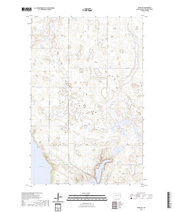
2024 Map of Pekin NE
USGS Topo · Published 2024About this map
Stump Lake dominates the southern landscape of this Nelson County region, its irregular shoreline and surrounding wetlands defining the local geography. The area is characterized by a high concentration of small kettle ponds and depressions, typical of the glaciated plains of North Dakota. A structured network of section-line roads, including 105th Ave NE and 38th St NE, organizes the rural terrain into a clear agricultural grid. Transport and transit are facilitated by State Hwy 1, which runs north-south through the lower half of the quadrangle, passing near the eastern edge of the lake. In the southeast, Silver Creek provides drainage, winding through the plains toward the water. This 2024 survey documents the contemporary state of these vital prairie water systems and the enduring township-and-range land divisions.
Find a feature on this map
21 named features on this map. Tap any name to fly to it.
Don’t see what you’re looking for? This feature index may not catch every label — zoom into the map to look around manually.
Map Details
Editions of this 2024 Pekin NE Map
This is the sole edition of this map. No revisions or reprints were ever made.
Other maps of this area

1930 · Pekin
USGS Topo · 1:62,500

1942 · McVille
USGS Topo · 1:62,500

1951 · Pekin NE
USGS Topo · 1:24,000

1951 · Pekin NW
USGS Topo · 1:24,000

1951 · Tolna
USGS Topo · 1:24,000

1951 · Pekin
USGS Topo · 1:24,000

1951 · Pekin
USGS Topo · 1:62,500

1952 · New Rockford
USGS Topo · 1:250,000

1953 · Devils Lake
USGS Topo · 1:250,000

1956 · New Rockford
USGS Topo · 1:250,000