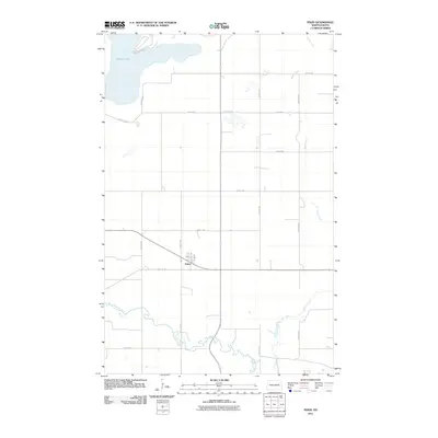
2011 Map of Pekin
USGS Topo · Published 2011About this map
Pekin serves as the central hub of this Nelson County landscape, situated at the intersection of several local routes in the southern portion of the quadrangle. The town's small street grid, including Main St, Anne Ave, and 2nd St, reflects the organized settlement patterns typical of the region's agricultural towns. The surrounding terrain is defined by a distinct hydrological network, where the Sheyenne River winds through the southern reaches and Silver Creek drains the eastern territory.
Find a feature on this map
19 named features on this map. Tap any name to fly to it.
Don’t see what you’re looking for? This feature index may not catch every label — zoom into the map to look around manually.
Map Details
Editions of this 2011 Pekin Map
This is the sole edition of this map. No revisions or reprints were ever made.
Other maps of this area

1930 · Pekin
USGS Topo · 1:62,500

1942 · McVille
USGS Topo · 1:62,500

1951 · Pekin NE
USGS Topo · 1:24,000

1951 · Pekin NW
USGS Topo · 1:24,000

1951 · Tolna
USGS Topo · 1:24,000

1951 · Pekin
USGS Topo · 1:24,000

1951 · Pekin
USGS Topo · 1:62,500

1952 · New Rockford
USGS Topo · 1:250,000

1956 · New Rockford
USGS Topo · 1:250,000

1961 · Kloten NW
USGS Topo · 1:24,000