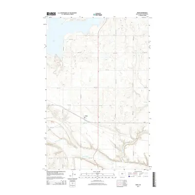
2014 Map of Pekin
USGS Topo · Published 2014About this map
Pekin sits at the junction of ND-1 and ND-15 in this detailed 2014 survey of Nelson County. The landscape is defined by the winding course of the Sheyenne River to the south and the eastern reach of Stump Lake in the northwest corner. This prairie terrain is organized by a strict grid of section roads like 105th Ave NE and 27th St NE, revealing the enduring agricultural layout of the region. The map identifies the local Post Office within the village of Pekin, a central hub for the surrounding rural townships. Tributaries such as Silver Creek cut through the undulating topography, moving toward the larger river valley and providing natural drainage for the vast North Dakota plains. The intersection of rail-era town placement and modern state highways illustrates the evolution of transport in this rural corridor.
Find a feature on this map
19 named features on this map. Tap any name to fly to it.
Don’t see what you’re looking for? This feature index may not catch every label — zoom into the map to look around manually.
Map Details
Editions of this 2014 Pekin Map
This is the sole edition of this map. No revisions or reprints were ever made.
Other maps of this area

1930 · Pekin
USGS Topo · 1:62,500

1942 · McVille
USGS Topo · 1:62,500

1951 · Pekin NE
USGS Topo · 1:24,000

1951 · Pekin NW
USGS Topo · 1:24,000

1951 · Tolna
USGS Topo · 1:24,000

1951 · Pekin
USGS Topo · 1:24,000

1951 · Pekin
USGS Topo · 1:62,500

1952 · New Rockford
USGS Topo · 1:250,000

1956 · New Rockford
USGS Topo · 1:250,000

1961 · Kloten NW
USGS Topo · 1:24,000