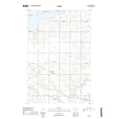
2018 Map of Pekin
USGS Topo · Published 2018About this map
Pekin sits as the central settlement in this portion of Nelson County, organized around a traditional grid that reflects the region's agricultural and transit-oriented development. The town's layout is anchored by Railroad Ave and the local Po, serving as a hub for the surrounding township sections. To the north, the expansive waters of Stump Lake dominate the terrain, while the southern reaches are defined by the winding course of the Sheyenne River and its tributary, Silver Cr. This landscape is characterized by numerous prairie potholes and depressions typical of the North Dakota plains, punctuated by quiet landmarks like the Pekin Cem. The road network, including Co Rd 16 and various numbered section line roads like 26th St NE, illustrates the enduring structure of the rural landscape in the early 21st century.
Find a feature on this map
22 named features on this map. Tap any name to fly to it.
Don’t see what you’re looking for? This feature index may not catch every label — zoom into the map to look around manually.
Map Details
Editions of this 2018 Pekin Map
This is the sole edition of this map. No revisions or reprints were ever made.
Other maps of this area

1930 · Pekin
USGS Topo · 1:62,500

1942 · McVille
USGS Topo · 1:62,500

1951 · Pekin NE
USGS Topo · 1:24,000

1951 · Pekin NW
USGS Topo · 1:24,000

1951 · Tolna
USGS Topo · 1:24,000

1951 · Pekin
USGS Topo · 1:24,000

1951 · Pekin
USGS Topo · 1:62,500

1952 · New Rockford
USGS Topo · 1:250,000

1956 · New Rockford
USGS Topo · 1:250,000

1961 · Kloten NW
USGS Topo · 1:24,000