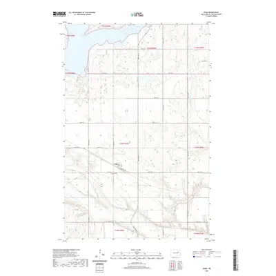
2020 Map of Pekin
USGS Topo · Published 2020About this map
Pekin serves as the central hub of this Nelson County landscape, where the local grid of Railroad Ave and Co Rd 16 defines the small-town layout. To the south, the Pekin Cem remains a significant site for genealogical research, situated just north of the winding course of the Sheyenne River. The geography is characterized by the numerous wetlands and depressions typical of the region, anchored in the north by the expansive waters of Stump Lake. Drainage through the eastern portion of the map is managed by Silver Cr, which meanders through a series of section lines and rural tracks. The survey illustrates a well-ordered township system, visible in the alignment of roads like 26th St NE and 31st St NE, which connect the outlying farmsteads to the municipal core at Pekin.
Find a feature on this map
21 named features on this map. Tap any name to fly to it.
Don’t see what you’re looking for? This feature index may not catch every label — zoom into the map to look around manually.
Map Details
Editions of this 2020 Pekin Map
This is the sole edition of this map. No revisions or reprints were ever made.
Other maps of this area

1930 · Pekin
USGS Topo · 1:62,500

1942 · McVille
USGS Topo · 1:62,500

1951 · Pekin NE
USGS Topo · 1:24,000

1951 · Pekin NW
USGS Topo · 1:24,000

1951 · Tolna
USGS Topo · 1:24,000

1951 · Pekin
USGS Topo · 1:24,000

1951 · Pekin
USGS Topo · 1:62,500

1952 · New Rockford
USGS Topo · 1:250,000

1956 · New Rockford
USGS Topo · 1:250,000

1961 · Kloten NW
USGS Topo · 1:24,000