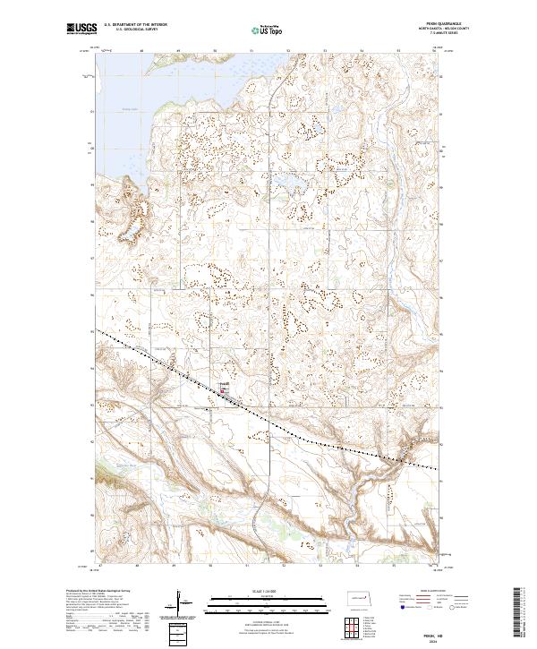
2024 Map of Pekin
USGS Topo · Published 2024About this map
Pekin serves as the central hub of this North Dakota landscape, situated along a grid of section-line roads and the aptly named Railroad Ave. The town is supported by local landmarks like the Pekin Cem to its west, while the surrounding terrain is defined by its significant water features and conservation lands. To the north lies the expansive Stump Lake, while the Sheyenne River meanders through the southwestern corner of the quadrangle. Conservation is a notable theme in this region, anchored by the Nelson County Waterfowl Production Area, which preserves the prairie pothole ecosystem between 105th Ave NE and 107th Ave NE. The drainage patterns are further marked by the presence of Silver Creek, which flows through the eastern townships, illustrating the transition between cultivated farmland and protected wetlands.
Find a feature on this map
27 named features on this map. Tap any name to fly to it.
Don’t see what you’re looking for? This feature index may not catch every label — zoom into the map to look around manually.
Map Details
Editions of this 2024 Pekin Map
This is the sole edition of this map. No revisions or reprints were ever made.
Other maps of this area

1930 · Pekin
USGS Topo · 1:62,500

1942 · McVille
USGS Topo · 1:62,500

1951 · Pekin NE
USGS Topo · 1:24,000

1951 · Pekin NW
USGS Topo · 1:24,000

1951 · Tolna
USGS Topo · 1:24,000

1951 · Pekin
USGS Topo · 1:24,000

1951 · Pekin
USGS Topo · 1:62,500

1952 · New Rockford
USGS Topo · 1:250,000

1956 · New Rockford
USGS Topo · 1:250,000

1961 · Kloten NW
USGS Topo · 1:24,000