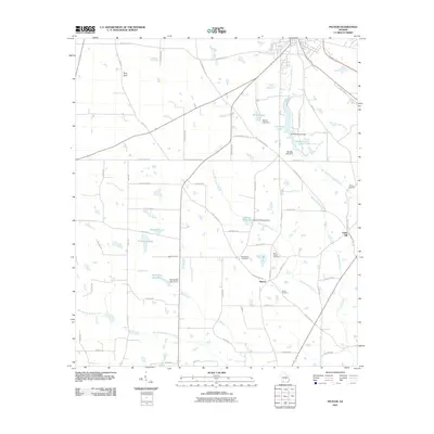
2011 Map of Pelham
USGS Topo · Published 2011About this map
Spence and Union Hill anchor this rural Mitchell County landscape, where the agricultural and hydrological character of Southwest Georgia is on full display. The area is defined by a complex network of tributaries, including East Branch Barnetts Creek and Spence Mill Creek, feeding into numerous managed water bodies and millponds. Significant local landmarks like Rich Sink suggest the underlying karst topography typical of the region, while man-made features such as Walton Lake Dam and McClendon Lake Dam indicate active water management for land use.
Find a feature on this map
57 named features on this map. Tap any name to fly to it.
Don’t see what you’re looking for? This feature index may not catch every label — zoom into the map to look around manually.
Map Details
Editions of this 2011 Pelham Map
This is the sole edition of this map. No revisions or reprints were ever made.
Other maps of this area

1953 · Dothan
USGS Topo · 1:250,000

1954 · Dothan
USGS Topo · 1:250,000

1954 · Tallahassee
USGS Topo · 1:250,000

1955 · Dothan
USGS Topo · 1:250,000

1955 · Whigham
USGS Topo · 1:62,500

1956 · Cairo
USGS Topo · 1:62,500

1959 · Tallahassee
USGS Topo · 1:250,000

1960 · Tallahassee
USGS Topo · 1:250,000

1971 · Meigs
USGS Topo · 1:24,000

1971 · Gee Pond
USGS Topo · 1:24,000