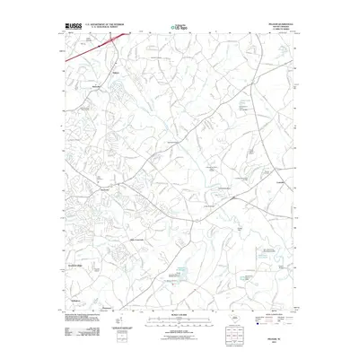
2011 Map of Pelham
USGS Topo · Published 2011About this map
The Enoree River winds through this Piedmont landscape, defining the geographic character of settlements like Pelham and Batesville. Near Pelham Falls, the river’s path is marked by historical crossing points such as Bennetts Bridge and Anderson Bridge, while the surrounding terrain is punctuated by small-scale aviation at Flight World Airport and Hughes Airport. The map documents a transition toward residential development, visible in communities like Woodland Village, Bellingham, and Ponderosa, yet it preserves a record of older rural life through numerous family and community burial grounds, including Mayfield Cemetery, Antioch Cemetery, and Vaughan Cemetery. Water management is a prominent feature, with several named dams and basins such as Harper's Folly Lake and G Brockman Pond illustrating the local engineering of tributaries like Peters Creek and Dillard Creek.
Find a feature on this map
187 named features on this map. Tap any name to fly to it.
Don’t see what you’re looking for? This feature index may not catch every label — zoom into the map to look around manually.
Map Details
Editions of this 2011 Pelham Map
This is the sole edition of this map. No revisions or reprints were ever made.
Other maps of this area

1935 · Greer
USGS Topo · 1:48,000

1935 · Greenville
USGS Topo · 1:48,000

1938 · Greenville
USGS Topo · 1:62,500

1938 · Greer
USGS Topo · 1:62,500

1954 · Greenville
USGS Topo · 1:250,000

1957 · Fountain Inn
USGS Topo · 1:62,500

1957 · Williamston
USGS Topo · 1:62,500

1957 · Greer
USGS Topo · 1:62,500

1957 · Greenville
USGS Topo · 1:62,500

1958 · Greenville
USGS Topo · 1:250,000