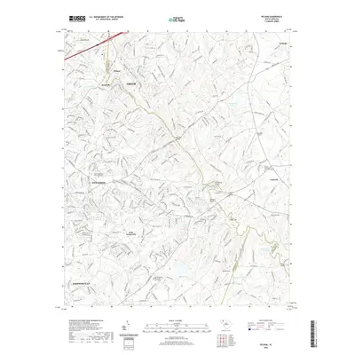
2020 Map of Pelham
USGS Topo · Published 2020About this map
The Enoree River winds through this Upstate South Carolina landscape, serving as a natural boundary between Greenville and Spartanburg counties. The terrain is defined by a dense network of tributaries including Dillard Cr, Gilder Cr, and Brushy Cr, which historically shaped the settlement patterns of towns like Pelham, Batesville, and Reidville. While Greer and Simpsonville mark the larger municipal footprints, the map is rich with local heritage sites, particularly its country churches and associated burying grounds. Genealogists will find interest in the Five Forks Baptist Church Graveyard, Antioch Presbyterian Church Graveyard, and Clear Spring Baptist Church Graveyard. Aviation history is noted at Chandelle Airport, while old river crossings are preserved in names like Bennetts Bridge, Anderson Bridge, and Cooper Bridge.
Find a feature on this map
50 named features on this map. Tap any name to fly to it.
Don’t see what you’re looking for? This feature index may not catch every label — zoom into the map to look around manually.
Map Details
Editions of this 2020 Pelham Map
This is the sole edition of this map. No revisions or reprints were ever made.
Other maps of this area

1935 · Greer
USGS Topo · 1:48,000

1935 · Greenville
USGS Topo · 1:48,000

1938 · Greenville
USGS Topo · 1:62,500

1938 · Greer
USGS Topo · 1:62,500

1954 · Greenville
USGS Topo · 1:250,000

1957 · Fountain Inn
USGS Topo · 1:62,500

1957 · Williamston
USGS Topo · 1:62,500

1957 · Greer
USGS Topo · 1:62,500

1957 · Greenville
USGS Topo · 1:62,500

1958 · Greenville
USGS Topo · 1:250,000