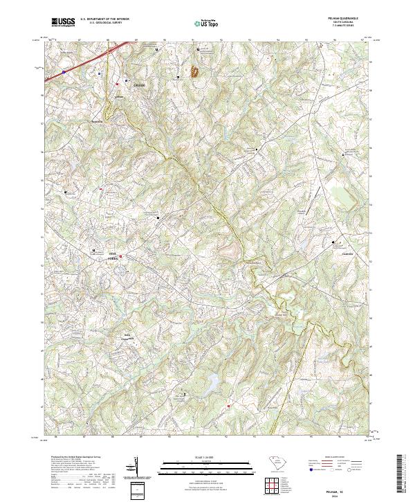
2024 Map of Pelham
USGS Topo · Published 2024About this map
The Enoree River winds through this landscape along the border of Greenville and Spartanburg counties, defining the geography of the Piedmont region south of Greer. This modern survey reveals a suburbanized corridor where long-standing rural communities like Five Forks, Pelham, and Batesville have evolved into bustling residential and commercial centers. Despite the growth surrounding Interstate 85, a dense network of local-history landmarks remains. Numerous historic burial grounds and places of worship, including the Fulton Presbyterian Church Graveyard and Sharon United Methodist Church Graveyard, are preserved amidst the development. Small-scale aviation facilities such as Chandelle Airport and the athletic grounds at Parker Field serve the local community, while the terrain's original character persists along the banks of Peters Creek, Gilder Creek, and the notable Horseshoe Bend of the Enoree.
Find a feature on this map
49 named features on this map. Tap any name to fly to it.
Don’t see what you’re looking for? This feature index may not catch every label — zoom into the map to look around manually.
Map Details
Editions of this 2024 Pelham Map
This is the sole edition of this map. No revisions or reprints were ever made.
Other maps of this area

1935 · Greer
USGS Topo · 1:48,000

1935 · Greenville
USGS Topo · 1:48,000

1938 · Greenville
USGS Topo · 1:62,500

1938 · Greer
USGS Topo · 1:62,500

1954 · Greenville
USGS Topo · 1:250,000

1957 · Fountain Inn
USGS Topo · 1:62,500

1957 · Williamston
USGS Topo · 1:62,500

1957 · Greer
USGS Topo · 1:62,500

1957 · Greenville
USGS Topo · 1:62,500

1958 · Greenville
USGS Topo · 1:250,000