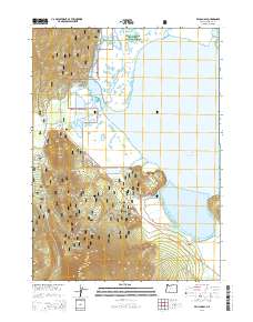
2014 Map of Pelican Bay
USGS Topo · Published 2014About this map
Rocky Point serves as a central landmark in this 2014 survey of the northwestern reaches of Upper Klamath Lake. The landscape is defined by the complex aquatic environment where the Upper Klamath National Wildlife Refuge meets the Winema National Forest. Numerous freshwater sources, including Harriman Spring, Odessa Spring, and Wampler Spring, feed into the lake through a network of creeks and the man-made Pelican Cut Canal. To the south, the terrain rises sharply toward the peak of Mt Harriman, while the shoreline is marked by prominent features like Coon Point and Ball Point. This map captures a modern view of the region's protected wetlands and forested uplands, highlighting the intricate boundaries of Pelican Bay and Ball Bay along the lake's western edge.
Find a feature on this map
41 named features on this map. Tap any name to fly to it.
Don’t see what you’re looking for? This feature index may not catch every label — zoom into the map to look around manually.
Map Details
Editions of this 2014 Pelican Bay Map
This is the sole edition of this map. No revisions or reprints were ever made.
Other maps of this area

1889 · Klamath
USGS Topo · 1:250,000

1891 · Ashland
USGS Topo · 1:250,000

1893 · Ashland
USGS Topo · 1:250,000

1894 · Klamath
USGS Topo · 1:250,000

1897 · Ashland
USGS Topo · 1:250,000

1955 · Lake O' Woods
USGS Topo · 1:62,500

1955 · Pelican Butte
USGS Topo · 1:62,500

1955 · Klamath Falls
USGS Topo · 1:250,000

1955 · Medford
USGS Topo · 1:250,000

1957 · Medford
USGS Topo · 1:250,000