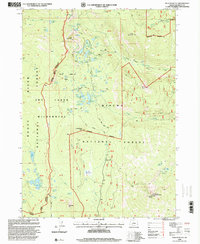
1998 Map of Pelican Butte
USGS Topo · Published 2000About this map
Pelican Butte dominates the southern landscape of this 1998 survey, standing as a prominent landmark within the Winema National Forest. The map documents a high-altitude wilderness defined by an extraordinary density of small mountain lakes, including the Dwarf Lakes Area and the Sky Lakes Area. These water bodies, such as Lake Sonya, Lake Isherwood, and the Heavenly Twin Lakes, are connected by an intricate network of footpaths like the Sky Lakes Trail and the Donna Lake Trail.
Find a feature on this map
65 named features on this map. Tap any name to fly to it.
Don’t see what you’re looking for? This feature index may not catch every label — zoom into the map to look around manually.
Map Details
Editions of this 1998 Pelican Butte Map
This is the sole edition of this map. No revisions or reprints were ever made.
Other maps of this area

1891 · Ashland
USGS Topo · 1:250,000

1893 · Ashland
USGS Topo · 1:250,000

1897 · Ashland
USGS Topo · 1:250,000

1955 · Lake O' Woods
USGS Topo · 1:62,500

1955 · Rustler Peak
USGS Topo · 1:62,500

1955 · Mt. Mc Loughlin
USGS Topo · 1:62,500

1955 · Pelican Butte
USGS Topo · 1:62,500

1955 · Medford
USGS Topo · 1:250,000

1957 · Medford
USGS Topo · 1:250,000

1958 · Medford
USGS Topo · 1:250,000