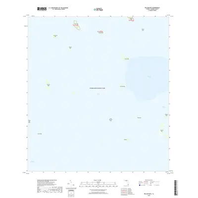
2018 Map of Pelican Keys
USGS Topo · Published 2018About this map
Everglades National Park encompasses this expansive maritime landscape within Florida Bay, where a network of small islands and shallow basins defines the coastal geography of Monroe County. The map details a complex hydrographic system including Whipray Basin and the winding Whipray Channel, which separate various low-lying landforms like Rankin Key and Jim Foot Key.
Find a feature on this map
22 named features on this map. Tap any name to fly to it.
Don’t see what you’re looking for? This feature index may not catch every label — zoom into the map to look around manually.
Map Details
Editions of this 2018 Pelican Keys Map
This is the sole edition of this map. No revisions or reprints were ever made.
Other maps of this area

1956 · Miami
USGS Topo · 1:250,000

1958 · Miami
USGS Topo · 1:250,000

1971 · Upper Matecumbe Key
USGS Topo · 1:24,000

1972 · Schooner Bank
USGS Topo · 1:24,000

1972 · Madeira Bay
USGS Topo · 1:24,000

1972 · Pelican Keys
USGS Topo · 1:24,000

1972 · West Lake
USGS Topo · 1:24,000

1972 · Buchanan Keys
USGS Topo · 1:24,000

1972 · Calusa Keys
USGS Topo · 1:24,000

1972 · Clive Key
USGS Topo · 1:24,000