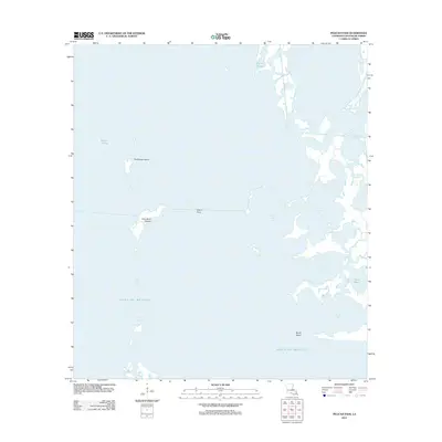
2012 Map of Pelican Pass
USGS Topo · Published 2012About this map
Philo Brice Islands and Northwest Island stand as isolated landmarks in this expanse of the Louisiana coast, where the marshy transition between land and the open Gulf of Mexico is constantly shifting. The landscape is defined by a intricate network of waterways and shallow basins, including Jacko Camp Bay, Landry Bay, and Pierle Bay. These features, along with names like China Bayou and Bayou l'Ourse, reflect the traditional naming conventions of the bayou country. The presence of Devils Island near Devils Bay at the southern edge of the sheet illustrates the fragmented nature of the shoreline. This 2012 survey provides a precise digital record of the coastal geomorphology before ongoing environmental changes further alter these low-lying landforms and tidal passages.
Find a feature on this map
14 named features on this map. Tap any name to fly to it.
Don’t see what you’re looking for? This feature index may not catch every label — zoom into the map to look around manually.
Map Details
Editions of this 2012 Pelican Pass Map
This is the sole edition of this map. No revisions or reprints were ever made.
Other maps of this area

1892 · Cheniere Caminada
USGS Topo · 1:62,500

1892 · Creole
USGS Topo · 1:62,500

1894 · Timbalier
USGS Topo · 1:62,500

1894 · Lake Felicity
USGS Topo · 1:62,500

1935 · Timbalier Island
USGS Topo · 1:31,680

1935 · Bay Courant
USGS Topo · 1:31,680

1935 · Pelican Pass
USGS Topo · 1:31,680

1935 · Mink Bayou
USGS Topo · 1:31,680

1935 · Calumet Island
USGS Topo · 1:31,680

1935 · Leeville
USGS Topo · 1:31,680