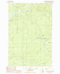
1985 Map of Pelletier Brook Lakes
USGS Topo · Published 1986About this map
The St John River carves through the northern timberlands of Aroostook County, serving as the dominant geographic feature in this section of the St Francis and Allagash regions. The landscape is defined by the systematic chain of the Pelletier Brook Lakes, ranging from First Pelletier Brook Lake through the Fifth Pelletier Brook drainage system. These water bodies, along with McLean Lake and Black Lake, provided essential corridors for the regional timber industry and early wilderness travel.
Find a feature on this map
29 named features on this map. Tap any name to fly to it.
Don’t see what you’re looking for? This feature index may not catch every label — zoom into the map to look around manually.
Map Details
Editions of this 1985 Pelletier Brook Lakes Map
This is the sole edition of this map. No revisions or reprints were ever made.
Other maps of this area

1930 · Allagash
USGS Topo · 1:48,000

1930 · St Francis
USGS Topo · 1:48,000

1931 · Fish River Lake
USGS Topo · 1:48,000

1932 · Allagash Falls
USGS Topo · 1:48,000

1933 · Allagash
USGS Topo · 1:62,500

1933 · St Francis
USGS Topo · 1:62,500

1935 · Fish River Lake
USGS Topo · 1:62,500

1935 · Allagash Falls
USGS Topo · 1:62,500

1954 · Presque Isle
USGS Topo · 1:250,000

1956 · Allagash Falls
USGS Topo · 1:50,000