
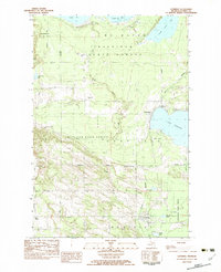
1982 Map of Pellston
USGS Topo · Published 1983About this map
Pellston and the surrounding Emmet County landscape are defined by the convergence of the Maple River and its East Branch as they wind through dense State Forest lands. This 1980s era survey captures a region heavily shaped by academic research and aviation, notably featuring the University of Michigan Biological Station and the Emmit County Airport. The settlement pattern is scattered, with small hubs like Van and Townhall serving as anchor points among a grid of rural roads like Ball Road and Stutsmanville Road.
Find a feature on this map
48 named features on this map. Tap any name to fly to it.
Don’t see what you’re looking for? This feature index may not catch every label — zoom into the map to look around manually.
Map Details
Editions of this 1982 Pellston Map
This is the sole edition of this map. No revisions or reprints were ever made.
Other maps of this area

1955 · Cheboygan
USGS Topo · 1:250,000

1957 · Wolverine
USGS Topo · 1:62,500

1957 · Mullett Lake
USGS Topo · 1:62,500

1958 · Cheboygan
USGS Topo · 1:250,000

1958 · Pellston
USGS Topo · 1:62,500

1958 · Petoskey
USGS Topo · 1:62,500

1975 · Petoskey NW
USGS Topo · 1:24,000

1975 · Petoskey NE
USGS Topo · 1:24,000

1982 · Petoskey
USGS Topo · 1:100,000
1982 · Levering
USGS Topo · 1:25,000