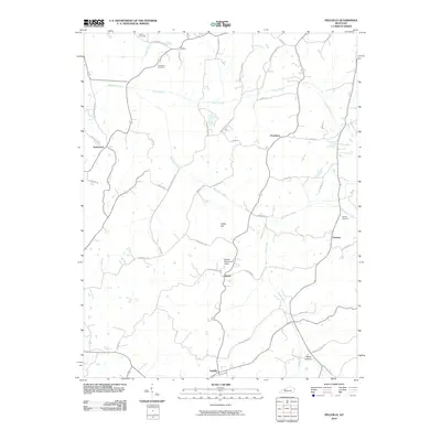
2010 Map of Pellville
USGS Topo · Published 2010About this map
Blackford Creek and its many tributaries, including Caney Creek and Horse Fork, define the drainage patterns of this rural Kentucky landscape. Small agricultural hubs and historic named settlements are scattered throughout the region, with Pellville at the southern edge and Utility to the north. These locales are connected by a dense network of country roads, such as Middle Knottsville Rd and Lewisport-Utility Rd, reflecting a long history of local travel between family farmsteads. Cultural landmarks like Schafer Memorial Camp and rural burial grounds including Chambers Cemetery and Powers Cemetery provide specific points of interest for genealogists. The geography is characterized by named rises and hollows, such as Indian Hill and Bates Hollow, which shaped the placement of early homesteads and the winding paths of the thoroughfares.
Find a feature on this map
48 named features on this map. Tap any name to fly to it.
Don’t see what you’re looking for? This feature index may not catch every label — zoom into the map to look around manually.
Map Details
Editions of this 2010 Pellville Map
This is the sole edition of this map. No revisions or reprints were ever made.
Other maps of this area

1903 · Tell City
USGS Topo · 1:62,500

1907 · Whitesville
USGS Topo · 1:62,500

1909 · Whitesville
USGS Topo · 1:62,500

1932 · Fordsville
USGS Topo · 1:62,500

1934 · Cannelton
USGS Topo · 1:62,500

1949 · Cannelton
USGS Topo · 1:24,000

1953 · Cannelton
USGS Topo · 1:24,000

1953 · Philpot
USGS Topo · 1:24,000

1953 · Lewisport
USGS Topo · 1:24,000

1953 · Cloverport
USGS Topo · 1:24,000