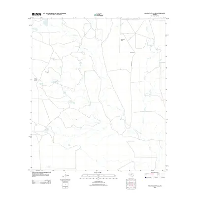
2013 Map of Peloncillo Peak
USGS Topo · Published 2013About this map
Peloncillo Peak stands as the primary topographical landmark in this arid stretch of Maverick County, which remains defined by ranching infrastructure and a complex network of ephemeral water catchments. The landscape is dotted with named tanks essential for livestock, including Snake Tank, Birdnest Tank, and the aptly named Hardluck Tank, reflecting the challenges of water management in south Texas. Significant drainage is provided by the branching systems of Elm Cr, Stricklin Cr, and Lindsey Cr. Human presence is concentrated around Dunbar Lake and the Dunbar Ranch Airport, indicating a large-scale landholding typical of the region. Transportation is limited to Anacacho Ln and Farm Road 481, which connect these remote ranch properties to the broader county network.
Find a feature on this map
20 named features on this map. Tap any name to fly to it.
Don’t see what you’re looking for? This feature index may not catch every label — zoom into the map to look around manually.
Map Details
Editions of this 2013 Peloncillo Peak Map
This is the sole edition of this map. No revisions or reprints were ever made.
Other maps of this area

1896 · Brackett
USGS Topo · 1:125,000

1897 · Brackett
USGS Topo · 1:125,000

1940 · Paloma
USGS Topo · 1:62,500

1940 · Chacon Creek
USGS Topo · 1:62,500

1944 · Spofford
USGS Topo · 1:62,500

1949 · Cline
USGS Topo · 1:62,500

1958 · Eagle Pass
USGS Topo · 1:250,000

1958 · Del Rio
USGS Topo · 1:250,000

1964 · Del Rio
USGS Topo · 1:250,000

1965 · Eagle Pass
USGS Topo · 1:250,000