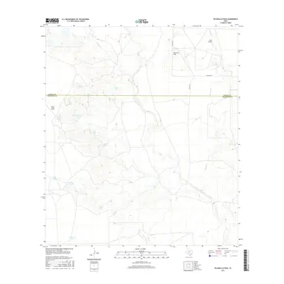
2016 Map of Peloncillo Peak
USGS Topo · Published 2016About this map
Peloncillo Peak stands as the primary landmark in this ranching landscape of the Southwest Texas scrubland. Spanning the Kinney Co and Maverick Co line, the terrain is defined by an extensive network of ephemeral drainage systems and water catchment features. Natural waterways like Elm Cr, Lindsey Cr, and Stricklin Cr are supplemented by numerous named stock tanks, including Hard Luck Tank, Birdnest Tank, and Pretty Tank, illustrating the critical importance of water management for cattle operations in this arid environment. Transportation through this remote borderlands region is facilitated by Farm Rd 481 and Anacacho Rd, while the Dunbar Ranch Airport and nearby Dunbar Lake mark a rare concentration of infrastructure amidst the rugged drainages of Beef Canyon.
Find a feature on this map
22 named features on this map. Tap any name to fly to it.
Don’t see what you’re looking for? This feature index may not catch every label — zoom into the map to look around manually.
Map Details
Editions of this 2016 Peloncillo Peak Map
This is the sole edition of this map. No revisions or reprints were ever made.
Other maps of this area

1896 · Brackett
USGS Topo · 1:125,000

1897 · Brackett
USGS Topo · 1:125,000

1940 · Paloma
USGS Topo · 1:62,500

1940 · Chacon Creek
USGS Topo · 1:62,500

1944 · Spofford
USGS Topo · 1:62,500

1949 · Cline
USGS Topo · 1:62,500

1958 · Eagle Pass
USGS Topo · 1:250,000

1958 · Del Rio
USGS Topo · 1:250,000

1964 · Del Rio
USGS Topo · 1:250,000

1965 · Eagle Pass
USGS Topo · 1:250,000