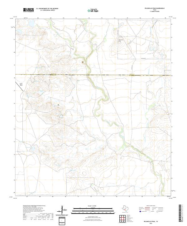
2022 Map of Peloncillo Peak
USGS Topo · Published 2022About this map
Peloncillo Peak rises as a primary landmark in this ranching landscape along the border of Kinney and Maverick Counties. The area is defined by a complex network of seasonal water drainage and livestock infrastructure, including numerous named stock ponds such as Snake Tank, Snow Tank, and Hard Luck Tank. These water sources are critical to the local economy, supporting operations centered around Dunbar Ranch Airport and nearby Dunbar Lake. The terrain is dissected by the meandering courses of Elm Creek and Lindsey Cr, which flow through the arid brush country of South Texas. Evidence of land use is visible in the network of rural routes like Anacacho Rd and Farm Rd 481, which connect remote ranch outposts. This detailed survey provides a clear view of the hydraulic and transportation patterns necessary for survival in this semi-arid environment.
Find a feature on this map
24 named features on this map. Tap any name to fly to it.
Don’t see what you’re looking for? This feature index may not catch every label — zoom into the map to look around manually.
Map Details
Editions of this 2022 Peloncillo Peak Map
This is the sole edition of this map. No revisions or reprints were ever made.
Other maps of this area

1896 · Brackett
USGS Topo · 1:125,000

1897 · Brackett
USGS Topo · 1:125,000

1940 · Paloma
USGS Topo · 1:62,500

1940 · Chacon Creek
USGS Topo · 1:62,500

1944 · Spofford
USGS Topo · 1:62,500

1949 · Cline
USGS Topo · 1:62,500

1958 · Eagle Pass
USGS Topo · 1:250,000

1958 · Del Rio
USGS Topo · 1:250,000

1964 · Del Rio
USGS Topo · 1:250,000

1965 · Eagle Pass
USGS Topo · 1:250,000