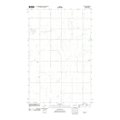
2011 Map of Pelto
USGS Topo · Published 2011About this map
Pelto sits as the central point of reference in this pocket of Nelson County, where the landscape is defined by the section-line grid of the Great Plains. The map reveals a high density of prairie potholes and small wetlands interspersed between agricultural plots and a network of rural roads like County Rd 22 and 110th Ave NE. This pattern of land use is characteristic of the region's agricultural history and the unique glacial geography of the Dakotas. Cultural markers such as the Finnish Cemetery and West Forest Cemetery provide vital points of interest for genealogists and local historians, reflecting the heritage of the settlers who established these rural communities. The sparse distribution of named features underscores the quiet, pastoral nature of the area in the early twenty-first century.
Find a feature on this map
17 named features on this map. Tap any name to fly to it.
Don’t see what you’re looking for? This feature index may not catch every label — zoom into the map to look around manually.
Map Details
Editions of this 2011 Pelto Map
This is the sole edition of this map. No revisions or reprints were ever made.
Other maps of this area

1953 · Devils Lake
USGS Topo · 1:250,000

1956 · Devils Lake
USGS Topo · 1:250,000

1970 · Lakota
USGS Topo · 1:24,000

1971 · Michigan West
USGS Topo · 1:24,000
1971 · Michigan East
USGS Topo · 1:24,000

1971 · Whitman
USGS Topo · 1:24,000

1971 · Brocket
USGS Topo · 1:24,000

1971 · Pelto
USGS Topo · 1:24,000

1972 · Adams SW
USGS Topo · 1:24,000

1972 · Lawton
USGS Topo · 1:24,000