
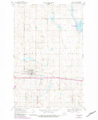
1970 Map of Lakota
USGS Topo · Published 1972About this map
The settlement of Lakota serves as the central hub of this Nelson County landscape, situated at the intersection of the Burlington Northern railroad and a major east-west highway corridor. This 1970 snapshot of the High Plains environment illustrates a mix of municipal infrastructure and the surrounding agricultural townships of Clara, Enterprise, and Rubin. To the west of the town center, a Cem and Radio Tower mark the transition toward more open acreage, while the Trailer Park and Lakota Municipal Airport suggest the town's mid-century expansion.
Find a feature on this map
23 named features on this map. Tap any name to fly to it.
Don’t see what you’re looking for? This feature index may not catch every label — zoom into the map to look around manually.
Map Details
Editions of this 1970 Lakota Map
2 editions found
Other maps of this area

1930 · Pekin
USGS Topo · 1:62,500

1942 · McVille
USGS Topo · 1:62,500

1951 · Pekin NE
USGS Topo · 1:24,000

1951 · Pekin NW
USGS Topo · 1:24,000

1951 · Pekin
USGS Topo · 1:62,500

1952 · New Rockford
USGS Topo · 1:250,000

1953 · Devils Lake
USGS Topo · 1:250,000

1956 · New Rockford
USGS Topo · 1:250,000

1956 · Devils Lake
USGS Topo · 1:250,000
1970 · Bartlett
USGS Topo · 1:24,000