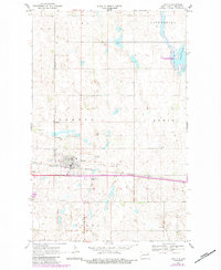
1970 Map of Lakota
USGS Topo · Published 1984About this map
Lakota stands as the primary hub of this Nelson County landscape, where the Burlington Northern railroad serves as the central artery for transportation and trade. The town’s 1970s infrastructure is well-defined, featuring the Waterworks, Substation, and a Trailer Park on the eastern edge. To the south, the Lakota Municipal Airport marks the transition from the structured town grid into the surrounding agricultural townships of Lakota, Clara, and Rubin.
Find a feature on this map
20 named features on this map. Tap any name to fly to it.
Don’t see what you’re looking for? This feature index may not catch every label — zoom into the map to look around manually.
Map Details
Editions of this 1970 Lakota Map
2 editions found
Other maps of this area

1930 · Pekin
USGS Topo · 1:62,500

1942 · McVille
USGS Topo · 1:62,500

1951 · Pekin NE
USGS Topo · 1:24,000

1951 · Pekin NW
USGS Topo · 1:24,000

1951 · Pekin
USGS Topo · 1:62,500

1952 · New Rockford
USGS Topo · 1:250,000

1953 · Devils Lake
USGS Topo · 1:250,000

1956 · New Rockford
USGS Topo · 1:250,000

1956 · Devils Lake
USGS Topo · 1:250,000

1970 · Lakota
USGS Topo · 1:24,000